

WTA Trailblazer: Go Hiking
Sviluppatore Washington Trails Association
Explore 4,000+ hikes in Washington with the state’s most trusted app. See the latest trail conditions and photos in thousands of trip reports. Find dog-friendly hikes and access verified directions to trailheads across the state, plus crucial info about required passes, permits, and closure alerts. Search, save, and access locally-researched and verified hike info offline. Washington Trails Association’s app lets you…
GET OUTSIDE SAFELY
- Trailhead weather forecasts from NOAA help you know what the weather’s like on trail
- Red alerts highlight trail closures, so you know about them before you get to the trailhead
- Trip reports written by other hikers include current road and trail conditions and seasonal features like ripe berries or fall foliage.
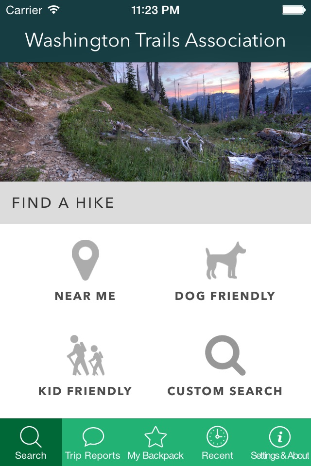
FIND A HIKE
- Customize your search with filters for length, elevation gain, passes and what features you want to see on trail (waterfalls, rivers, great views, etc.)
- Find hikes near you using your phone’s location, or using WTA’s Hike Finder Map or region filters
- Find hikes based on pass and permit requirements
- Kid-, dog- and wheelchair-friendly trails with dedicated filters for each.
- Difficulty ratings help you decide if a hike is right for you.
CUSTOMIZE YOUR EXPERIENCE
- Creating an account with WTA lets you write your own trip reports, save hike information for later, and access it offline, including the driving directions to the trailhead and detailed trail descriptions. Plus, when you have an account, you can:
- File your own trip reports and share the pictures you took on trail
- View and write comments on trip reports
- Like other user’s trip reports
- Sync your app activity with the web version of wta.org, where you can mark hikes as done and access our hike recommender. The more hikes you save and trip reports you write, the better the recommendations you get.